


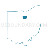
BRONSON TWP 1, Huron County, Ohio
About
Outline

Summary
| Unique Area Identifier | 648028 |
| Name | BRONSON TWP 1 |
| County | Huron County |
| State | Ohio |
| Area (square miles) | 13.12 |
| Land Area (square miles) | 13.11 |
| Water Area (square miles) | 0.02 |
| % of Land Area | 99.87 |
| % of Water Area | 0.13 |
| Latitude of the Internal Point | 41.16670290 |
| Longtitude of the Internal Point | -82.57018500 |
Maps


Graphs
Select a template below for downloading or customizing gragh for BRONSON TWP 1, Huron County, Ohio


Neighbors
Neighoring Voting District (by Name) Neighboring Voting District on the Map
- BRONSON TWP 2, Huron County, OH
- FAIRFIELD TWP, Huron County, OH
- FITCHVILLE TWP, Huron County, OH
- HARTLAND TWP, Huron County, OH
- NORWALK TWP SOUTH, Huron County, OH
Top 10 Neighboring County Subdivision (by Population) Neighboring County Subdivision on the Map
- Norwalk township, Huron County, OH (3,591)
- Bronson township, Huron County, OH (1,973)
- Fairfield township, Huron County, OH (1,218)
- Hartland township, Huron County, OH (1,112)
- Fitchville township, Huron County, OH (1,056)
Top 10 Neighboring Unified School District (by Population) Neighboring Unified School District on the Map
- Norwalk City School District, OH (19,063)
- Western Reserve Local School District, OH (6,730)
- New London Local School District, OH (6,038)
- South Central Local School District, OH (4,983)